
Case Study Profiles
- Home
- EPA Presentations
- Principles for Ecological Land Reuse
- Soil Science
- Soil Amendments
- Terrestrial Carbon Sequestration
- Plants and Revegetation
- Growing Gardens in Urban Soils
- Ecosystem Services
- Creating Pollinator Habitats as Part of an Ecological Revitalization Project
- Act Locally
- Land Revitalization Assistance
- Case Study Profiles
- Publications, Resources, and Links
- Glossary of Ecological Land Reuse Terms
EPA has successfully implemented ecological revitalization projects at several contaminated sites. This page presents some of these success stories. For a more detailed list of successful ecological revitalization projects, please see Appendix A of Ecological Revitalization –Turning Contaminated Properties into Community Assets.

The Ecological Revitalization Project Profiles Database contains information about completed and on-going projects where ecological revitalization was involved in solutions to various environmental concerns.
A fact sheet providing an overview of the Ecological Revitalization Database can be found here:
Ecological Revitalization Database Fact Sheet
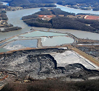
Bayou Verdine
At the Bayou Verdine site in Calcasieu Estuary, West Lake, Louisiana, decades of contaminants from heavy industry, refinery operations, and stormwater runoff built up in the sediments and surface water. EPA identified high levels of metals and hazardous chemicals at the site and began cleanup in 2012. The cleanup included removing contaminated sediments and restoring parts of the bayou shoreline. It also included actions to improve the ecological function of the area. Removal of sediments from a pond created an open-water riparian habitat. EPA and its partners connected the pond to the wetland environment of Bayou Verdine through a drainage bioswale designed to reduce erosion and provide more wildlife and fish habitat. Parties also seeded areas with native wildflowers to create a pollinator habitat.
Nyanza Chemical Waste Dump
The 35-acre Nyanza Chemical Waste Dump Superfund site in Ashland, Massachusetts, formerly housed operations that manufactured textile dyes, dye intermediates and other related products from 1917 to 1978. Operations buried solid waste on-site and released manufacturing wastewater onto on-site lagoons. This contaminated soil, sediment and groundwater with mercury and volatile organic compounds such as trichlorethylene. EPA began cleanup at the site in the 1980s. EPA excavated sludge and contaminated soils and sediment, capped the landfill, installed vapor mitigation systems in buildings and installed groundwater extraction wells. From 1999 to 2001, EPA worked to restore affected wetlands on site, including the 5.5-acre Eastern Wetland. EPA dug up mercury-contaminated sediments and monitored fish tissue for mercury in the Sudbury River.
Ciba-Geigy Corp.
The 1,250-acre Ciba-Geigy Corp. Superfund site in Toms River, New Jersey, is a former resin and dye manufacturing facility. Improper chemical waste disposal contaminated soil and groundwater at the site. EPA's cleanup actions included excavation and off-site disposal of contaminated material, treatment of contaminated soil, installation of caps and slurry walls to prevent contamination migration, installation of a groundwater extraction, treatment and recharge system, and institutional controls. In 2009, BASF acquired the site property from Ciba-Geigy. BASF partnered with high school environmental classes to conduct wildlife surveys on the site. The company hosts tours that teach students about the site's history, contamination and cleanup, as well as wildlife species on site. During redevelopment of the site, paved areas were replaced with wildflowers and vegetation to enhance local habitat for the threatened Grasshopper Sparrow and Northern Pine Snake.
Lower Darby Creek Area
The Lower Darby Creek Area Superfund site along Darby and Cobbs Creeks in Pennsylvania includes two landfills that were active from the 1950s to 1970s. The landfills accepted municipal, demolition and hospital wastes. The landfills likely affected creeks and wetlands through surface erosion, runoff and seeps, contributing to site contamination. EPA's cleanup of the site involved excavation and disposal of contaminated waste and cleanup and remediation of residential yards. Cleanup actions also included using natural features to reinforce the shoreline, providing improved habitat along the streambank. The cleanup included 16 acres of municipal park and open space and over 4,000 feet of streambank. Cleanup is ongoing at the John Heinz National Wildlife Refuge, a 1000-acre national wildlife refuge managed by the U.S. Fish and Wildlife Service.
Croydon TCE
The Croydon TCE Superfund site covers 3.5 square miles between the townships of Croydon and Bristol in Pennsylvania. In 1985, EPA found contamination at the site after an investigation at a neighboring industrial plant discovered groundwater contamination. Contaminants like trichloroethylene were detected in the groundwater and surface water. No source of the contamination was found. EPA began cleanup of the site in 1987, which included installing a groundwater treatment system and connecting homes impacted by the groundwater contamination to the public water supply. Cleanup is ongoing at the site. In 2016, the Heritage Conversancy gained ownership of the site and three years later opened the Croydon Woods Nature Preserve on the site, one of the last remaining coastal plain forests in the state. In 2019, EPA presented the Heritage Conservancy with its Excellence in Site Reuse Award for outstanding work in the reuse that turned a formerly contaminated forest into a nature preserve.

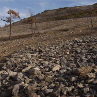
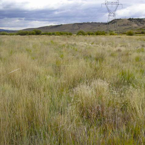
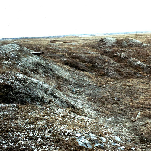
Anaconda Smelter Superfund Site, Anaconda, MT
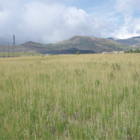
Perennial grasses now cover the Site
EPA's ecological revitalization efforts helped restore vital grasslands at the Anaconda Smelter Site.
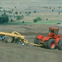
Soil Tilling at the Anaconda Smelter Site
Contamination from nearly 100 years of copper smelter operations affected the health and quality of the environment at the Ancaconda Smelter Site. Estimates indicate that more than a billion gallons of groundwater were contaminated and thousands of acres of soil were affected by fluvially transported mine wastes and smelter emissions. The massive 300-square-mile site area and variable, rugged terrain provided major remedial design challenges. The innovative site evaluation and assessment techniques, paired with effective remedial processes such as tilling and adding soil amendments, have helped restore these vital grasslands and ranch areas. The uplands remediation and ecological revitalization efforts have served to provide key lessons and replicable assessment techniques for other sites with area-wide contamination.
Palmerton Zinc Pile Superfund Site, Palmerton, PA
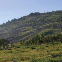
Blue Mountain After
Before and after photographs of Blue Mountain, adjacent to the zinc smelter site. Soil amendments and revegetation over a 10-year period has restored 70 percent of the site's vegetative cover.
Photographs appear in "Palmerton Zinc Pile, Palmerton, Carbon County, Pennsylvania, Superfund Case Study" factsheet.
Blue Mountain Before
Over 80 years of zinc smelting operations at the Palmerton Zinc Superfund Site left surface soils, shallow groundwater, and stream sediments contaminated with heavy metals. Large quantities of zinc, lead, cadmium, and sulfur dioxide emitted by two former zinc smelters from the late 1800s to 1980 damaged vegetation and defoliated over 2,000 acres of land. With no plants to keep the soil in place, erosion of contaminated soil impacted the nearby Lehigh River and Aquashicola Creek. To stabilize the contaminated soil, the site was revegetated using a variety of ecological revitalization techniques that evolved over time and took into consideration up-to-date technologies. Revegetation has stabilized the treated area, reduced soil erosion, and improved water quality associated with runoff from the site. A 450-acre portion of the site is now filled with warm-season grasses and is the home of the Lehigh Gap Nature Center, where both wildlife and the public are able to enjoy the lush open space.
Occidental Chemical Corporation, Montague, Michigan RCRA Case Study
Occidental Site After
Before and after photos show the transformation of the Occidental Site in Montague, Michigan.
Occidental Site Before
This is the story of the transformation of a former chemical manufacturing site into thriving wetland, prairie, and woodland habitat. The closure of Occidental Chemical Corporation (Oxy) facility in Montague, Michigan in 1983 left behind soil and ground water contaminated with chlorinated organic chemicals. Habitat preservation is an Oxy corporate principle so after meeting the EPA cleanup standards they also provided an ecological asset for the community. The surrounding countryside is a mix of hardwood forests, pine plantations, dunes and grasslands, homes, summer cottages, beaches and towns, in the Lake Michigan basin.
Rather than leave a brownfield in its wake, a few individuals at Oxy spearheaded the transformation of the former chemical manufacturing site into a thriving prairie, savannah, woodland, and wetland habitat. The restoration plans included amending soils, creating wetlands, and planting native grasses, shrubs, and trees as well as long-term stewardship activities and the creation of
recreational opportunities.
Atlas Tack Superfund Site, Massachusetts
Atlas Site After
Before and after photographs of the Atlas Tack Superfund Site in Massachusetts, where the remedy resulted in preservation of wetland sediment and created a functioning wetland.
Photographs courtesy of Elaine Stanley, EPA Region 1.
Atlas Site Before
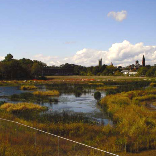
The Atlas Tack Superfund site is a former manufacturing facility where the ground water was contaminated with cyanide and toluene, and the soil was contaminated with volatile organic compounds, heavy metals, pesticides, polycyclic aromatic hydrocarbons, and polychlorinated biphenyls (PCBs). Cleanup activities at the site focused on the removal of buildings, contaminated soil, and sediment. The cleanup preserved as much of the wetland sediment as possible and provided the necessary mix of fresh and salt water sources to create a functioning wetland, in addition to protecting human health and the environment.
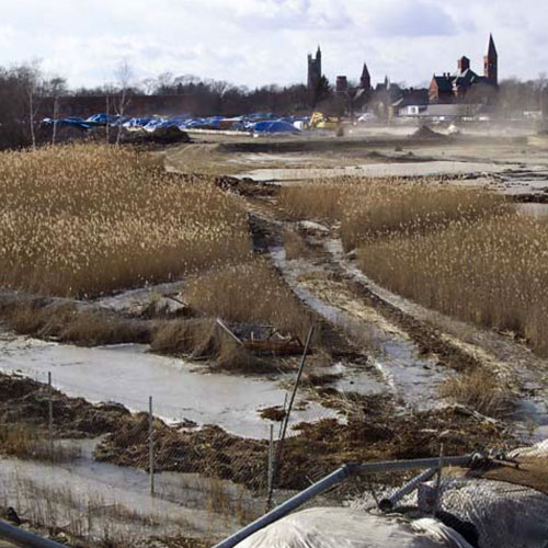
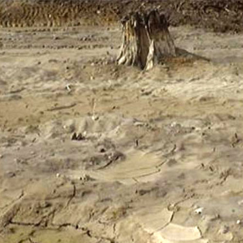
Bunker Hill Superfund Site (West Page Swamp Wetland Restoration Project), Idaho
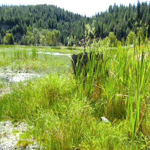
Bunker Hill Site After
Before and after photographs of the Bunker Hill Superfund Site in Idaho, where contamination was left on-site and capped with biolsolids compost and wood ash. A long-term Operations & Maintenace plan was established to ensure that attractive nuisance issues did not exist.
Photographs courtesy of Dr. Sally Brown, University of Washington.
Bunker Hill Site Before
The West Page Swamp was once used as a tailings repository for a mill that processed zinc and lead ore. The soil material consisted of highly contaminated lead and zinc tailings, materials so toxic that the swamp showed no evidence of ecosystem function. Remediation included constructing a cap over the soil. The cap consisted of biosolids, compost and wood ash. This cap was sufficient to reduce both accessibility and bioavailability of the underlying tailings and restore ecosystem function, characteristic of a naturally occurring wetland to the site. The wetland is now fully functioning and a wildlife habitat.
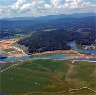
California Gulch Superfund Site in Colorado
California Gulch Site After
Before and after photographs of the California Gulch Superfund Site in Colorado where site managers used high rates of lime amendment to neutralize the acidity of the mine tailings and applied municipal biosolids directly into the tailings along the Upper Arkansas River.
Photographs courtesy of Michael Holmes, EPA Region 8.
California Gulch Site Before
An excellent example of remediation to reuse is the California Gulch Superfund site in Leadville, CO. Leadville was once one of the richest mining districts in the world. Silver, gold, copper, zinc, manganese and lead sustained the area's mining and smelting for more than 140 years. Mining operations ceased and the area�s soil, surface water, and sediments were heavily contaminated with heavy metals. As part of the remedy, biosolids and lime were applied directly to the tailings along the Upper Arkansas River which led to habitat revitalization over the last 20 years (when remediation began). Due to the heavy metal pollution, trout could not survive in the river. Today, trout are thriving for up to 10 years due to this habitat revitalization and improved water quality. Earlier in 2014, the Colorado Parks and Wildlife Commission announced the Upper Arkansas River as the newest addition to their statewide list of Gold Medal Trout Waters. This award is given to a body of water that consistently supports a minimum of trout stock of 60 pounds per acre and minimum average of 12 quality trout (14 inch length) per acre. EPA is proud to have played a role with the Leadville community to revitalize this area to now support vegetation and wildlife, and agriculture and recreational uses such as hiking, fishing, and bicycling.
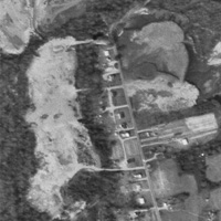
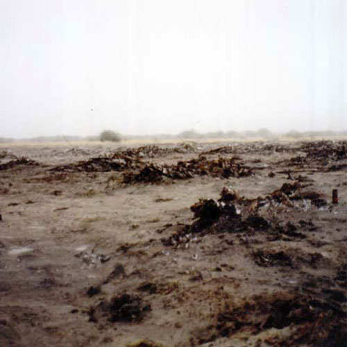
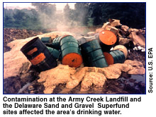
Army Creek Landfill site in Delaware
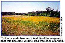
Army Creek Landfill site After
Before and after photographs of the Army Creek Landfill site in Delaware. Site managers used a protective cap and native vegetation to convert a municipal and industrial waste landfill that had been in operation for nine years into wetlands and wildlife habitat.
Photographs courtesy of U.S. Environmental Protection Agency
Army Creek Landfill site Before
The Army Creek Landfill site is a 47 acre abandoned sand and gravel quarry that was used as a municipal and industrial waste landfill for over nine years. The soil and groundwater were contaminated with chromium, mercury, and volatile organic compounds. Remediation activities at the site included a multi-layer protective cover and a groundwater treatment system. In addition, native vegetation was planted to create a bird and wildlife habitat, and wetlands were created to help prevent flooding and create additional habitat.
Coal Mine Spoil Site in Fulton County, Illinois
Coal Mine Spoil site After
Before and after photographs of the coal mine spoil area in Fulton County, Illinois where anaerobically digested municipal biosolids were directly applied over a 30 plus year period.
Photographs courtesy Guanglong Tian, Metropolitan Water Reclamation District of Greater Chicago (WRD).
Coal Mine Spoil Site Before
While once fertile farm land, a 6,000 hectare area was strip mined for its coal. The mine spoils consisted primarily of unconsolidated overburden soils and consolidated materials such as shale or sandstone bedrock. In 1972 the WRD divided the land into two large parcels according to spoil type plus control areas. At first liquid biosolids (4% solids) were applied directly to the mine spoils. Later the solids content was increased to 60 to 70%. Over time the net carbon (C) sequestration in the soil increased to 1.73 (0.54-3.05) Mg C ha-1 yr-1 in biosolids-amended fields as compared with -0.07 to 0.17 Mg C ha-1 yr-1 in fertilizer controls. The area has been returned to fertile agricultural land and is classified as a C-sink soil as opposed the normal Midwest Corn Belt soils' C-neutral classification.
JEB Little Creek - Fort Story, Virginia Beach, Virginia
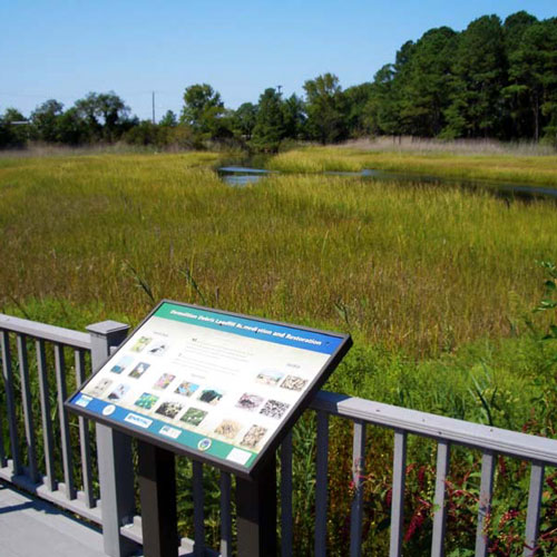
JEB Little Creek site After
Before and after pictures of a portion of the site which was re-vegetated using native grass species. This native vegetation has thrived after two years of growth.
Photographs appear in "JEB Little Creek - Fort Story, Virginia Beach, Virginia FFRRO Case Study" factsheet.
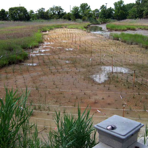
JEB Little Creek Site Before
Past disposal practices at the Joint Expeditionary Base (JEB) Little Creek - Fort Story site along the Chesapeake Bay area in Virginia Beach, Virginia, left a tidal wetlands area filled with debris, contaminated soil, and sediment. After waste materials were excavated, the landfill was converted to a tidal wetland. Two connecting channels were constructed to allow tidal inundation of the site from Little Creek Cove. Plants were selected and planted along designated elevations to establish native tidal wetland vegetation for habitat, using the neighboring marsh as a reference wetland.
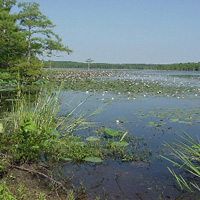
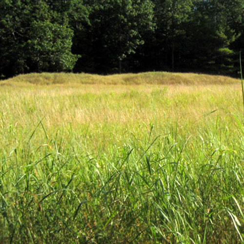
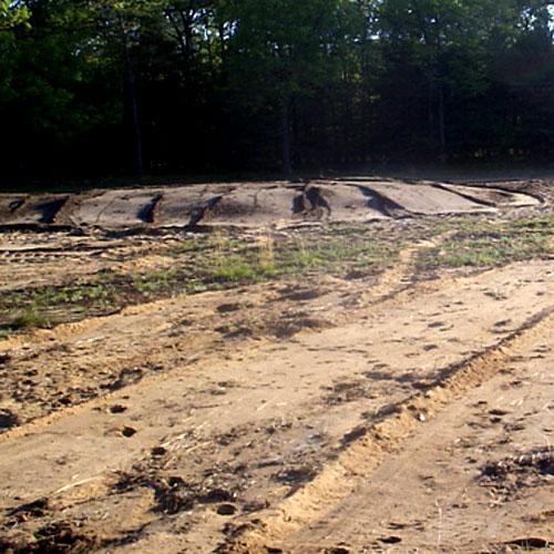
Bunker Hill Mining and Metallurgical Complex (OU2 and 3), Idaho
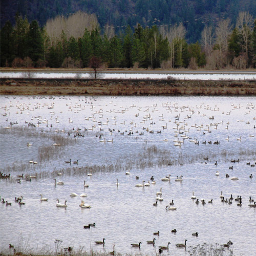
EPA's remedial action established nearly 400 acres of clean waterfowl feeding habitat at the Bunker Hill Mining and Metallurgical Complex, Idaho
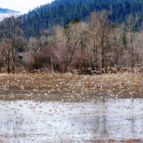
Remediated and restored habitat on the Bunker Hill site attracts some of the highest levels of waterfowl usage, feeding and diversity in the Coeur d'Alene River Basin.
The hillsides within the Bunker Hill Box non-populated areas (OU2) are returning to a coniferous forest ecosystem. The transformation is the result of efforts to reduce pollution of the South Fork of the Coeur d'Alene River by controlling erosion and increasing soil development. Adaptive management during the cleanup and ecological revitalization process allowed for flexible decision-making.
At the site's OU3 about 25 miles west of OU2 and downstream along the Coeur d'Alene River, a private, contaminated agricultural property was converted to healthy wetland habitat. Lead-contaminated soil and sediment throughout the lower river floodplains adversely affected wildlife. EPA's 2002 Superfund cleanup plan called for remediation of soil, sediment and water contaminated with toxic levels of heavy metals to create habitats capable of supporting a functional ecosystem and prevent ingestion and dermal contact by ecological receptors. Settlement money funded EPA's remedial action, which established nearly 400 acres of clean waterfowl feeding habitat. Additional restoration work by the Natural Resource Trustees followed. Use of buckwheat and other native herbaceous plants helped create an attractive habitat for wildlife and pollinators. Monitoring by the U.S. Fish and Wildlife Service shows that the remediated and restored habitat attracts some of the highest levels of waterfowl usage, waterfowl feeding and waterfowl diversity in the Coeur d'Alene River Basin. Blood lead data suggest that waterfowl using the conservation easement are experiencing reduced exposures to lead. This project is the first of its kind in the Coeur d'Alene River Basin, and is an important step in addressing serious ecological contamination issues in the basin.
At the site's OU3 about 25 miles west of OU2 and downstream along the Coeur d'Alene River, a private, contaminated agricultural property was converted to healthy wetland habitat. Lead-contaminated soil and sediment throughout the lower river floodplains adversely affected wildlife. EPA's 2002 Superfund cleanup plan called for remediation of soil, sediment and water contaminated with toxic levels of heavy metals to create habitats capable of supporting a functional ecosystem and prevent ingestion and dermal contact by ecological receptors. Settlement money funded EPA's remedial action, which established nearly 400 acres of clean waterfowl feeding habitat. Additional restoration work by the Natural Resource Trustees followed. Use of buckwheat and other native herbaceous plants helped create an attractive habitat for wildlife and pollinators. Monitoring by the U.S. Fish and Wildlife Service shows that the remediated and restored habitat attracts some of the highest levels of waterfowl usage, waterfowl feeding and waterfowl diversity in the Coeur d'Alene River Basin. Blood lead data suggest that waterfowl using the conservation easement are experiencing reduced exposures to lead. This project is the first of its kind in the Coeur d'Alene River Basin, and is an important step in addressing serious ecological contamination issues in the basin.
